A month's worth of rain: significant rain causes flooding, road closures

12.20pm UPDATE: Due to current rainfall, the sewer system in Blenheim and Seddon is at capacity. People are asked not to flush toilets in Blenheim and Seddon today.
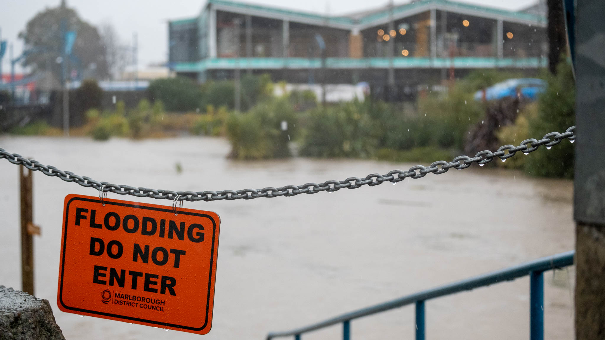
11.30am UPDATE: Flooding has closed State Highway 1. Waka Kotahi is advising motorists to delay journeys south, as the road between Blenheim and Seddon is now closed due to flooding.
SH 63 St Arnaud to Renwick is also closed.
Kaituna-Tuamarina Road is closed between SH6 and Waikakaho Road intersection.
Significant heavy rain has prompted a slew of warnings for people travelling in the Top of the South.
NIWA is warning of flooding risk as a month’s worth of rain is forecast for the eastern and northern South Island and the North Island.

Council and emergency management are advising people to stay off the roads if possible and to not drive through flood water.
In an update from council, officials say they’re keeping a close eye on the forecast and key agencies including Council, Waka Kotahi, Marlborough Roads, Police and Fire and Emergency are making plans in case roads need to be closed due to flooding or slips.
“It’s likely that stream and rivers will rise rapidly, particularly on the East Coast. Surface flooding and land slips are possible. East Coast settlements such as Ward, Seddon, Rarangi and Port Underwood are likely to receive significant rainfall. Parts of the Marlborough Sounds including the Kenepuru and Picton may be affected.
“There may also be surface flooding in Blenheim and surrounds, particularly at river ford crossings on the Wairau Plain.”

Described by Niwa as a river in the sky, an atmospheric river is streaming from the tropics down toward Aotearoa New Zealand.
Metservice says the deep low-pressure system is also forecast to bring strong winds to many with potential for severe northeast gales for much of the North Island, and for western parts of the South Island from the Marlborough Sounds through to Westland.
People are advised to heed weather warnings and keep an eye on the MetService website or app, and follow news reports.
Waka Kotahi are reminding motorists remember to switch on your vehicle’s lights, increase your following distance, and be prepared for unexpected hazards.
USEFUL LINKS
You can check State Highway conditions on Waka Kotahi’s interactive travel info map: journeys.nzta.govt.nz/traffic/southisland
The Metservice major weather warnings can be found at https://www.metservice.com/warnings/home
Council's live Floodwatch and Rainfall Reports: http://hydro.marlborough.govt.nz/
ROADS CLOSED
- SH63 between Renwick and St Arnaud
- SH1 south of Blenheim between the Roadhouse Drive and Seddon
- Kaituna-Tuamarina Road between SH6 and Waikakaho Road intersection
- Awatere Valley Road at SH1 turnoff
Omaka Ford on Old Renwick Road - Jacksons Road and Thompsons Ford Road.
- Brookby Road at Fairhall.
SLIPS
- Northbank Road, multiple slips near SH6 turnoff
- Tumbledown Bay Road, 9.5km from Port Underwood Road intersection
- Kenepuru Road Tree across road at Broughton Bay
- Queen Charlotte Drive slip near number 2723, between Shakespeare and Ngakuta bays
FLOODING
- Pukaka Road and Pembers Road intersection at Tuamarina
- Pukaka Valley Road
- Godfrey’s Road
- Howick Road and Wither Road intersection
- Weld Street and Muller Road
- Old Renwick Road Hammerichs Road intersection
- New Renwick Road - near 720
- Hawkesbury Road
- Vickerman Street
- SH1 Grove Road outside Couplands, Blenheim
- SH1 South from Picton - multiple sites: 2km south from the Para swamp passing lane, Koromiko Airport and leaving Picton.
- SH1 South from Blenheim multiple sites: south of the Waima/Ure River: at Lions Back 2km south of Seddon at Awatere Valley Road turnoff; and southbound before Redwood Pass, Ward near Flaxbourne Bridge.
- SH6 at Te Hoiere Road, five minutes from Havelock towards Nelson
- SH63 Inkerman Street - between Inkerman and Anglesea unpassable, detour in place.
- SH6 20km from Blenheim at Bomford Street intersection
- Waihopai Valley at the SH63 intersection
- Northbank Road, tree down 3.2km from the SH6 turnoff.
- Port Underwood Road
- Two fords on Old Renwick Road at Jacksons Road and O’Dwyers Road
- Onamalutu Road, 1km from Northbank Road turnoff
- Wakamarina, Ronga and Opouri Roads.
- Redwood St at the Hale St intersection; McCartney St; Taylor Crescent and Houldsworth St, Blenheim.
CLOSURES
- Taylor River Dam Reserve, the Wairau River Reserve and Simonsen Reserve are closed.