Scenic shots for science’s sake
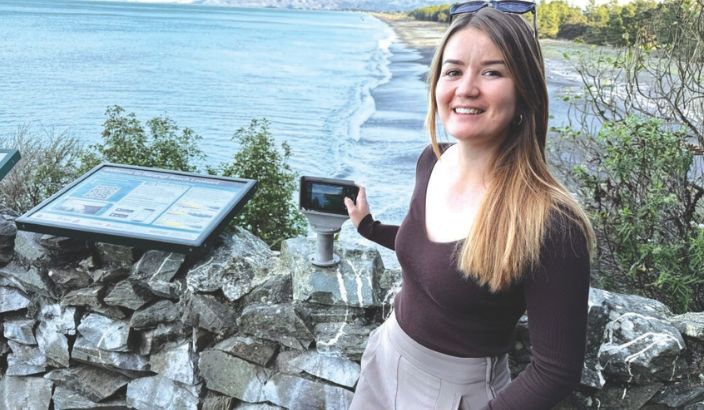
Council Coastal Scientist, Jorgia McMillan, stands beside the newly-installed CoastSnap station overlooking Rarangi Beach. Photo: Supplied.
Marlborough District Council is asking Monkey Bay track walkers to contribute to tracking environmental changes at Rārangi Beach with phone cameras.
The Council has partnered with CoastSnap to install a community photography station at the lookout on the steps to Monkey Bay, hoping to monitor coastal changes through the lens of walkers’ phones.
Council Coastal Scientist Jorgia McMillan says community-driven data collection is important as locals can contribute to understanding how their coastal environment is changing at one of the region’s popular beaches.
“CoastSnap will help Council track how the coast is changing over time due to storms, rising sea levels, human activities and other factors.
“This is a long-term project and the more photos taken the better, as after five years we will be able to analyse the data and see how the coastline has changed and potentially forecast future shifts.” The cradle ensures that all images are captured from the same viewpoint.
CoastSnap is a global citizen science project that captures changing coastlines. It was established in 2017 as a pilot project between the UNSW Water Research Laboratory and the NSW Department of Planning, Industry and Environment.
To take a photo, walkers place phones in the cradle, take a photograph of the view and then scan the QR code at the station which uploads it to the CoastSnap website.
Alternatively, regular walkers can download the free CoastSnap App or share your photo on social media with #CoastsnapRārangi.