
News from Marlborough District Council

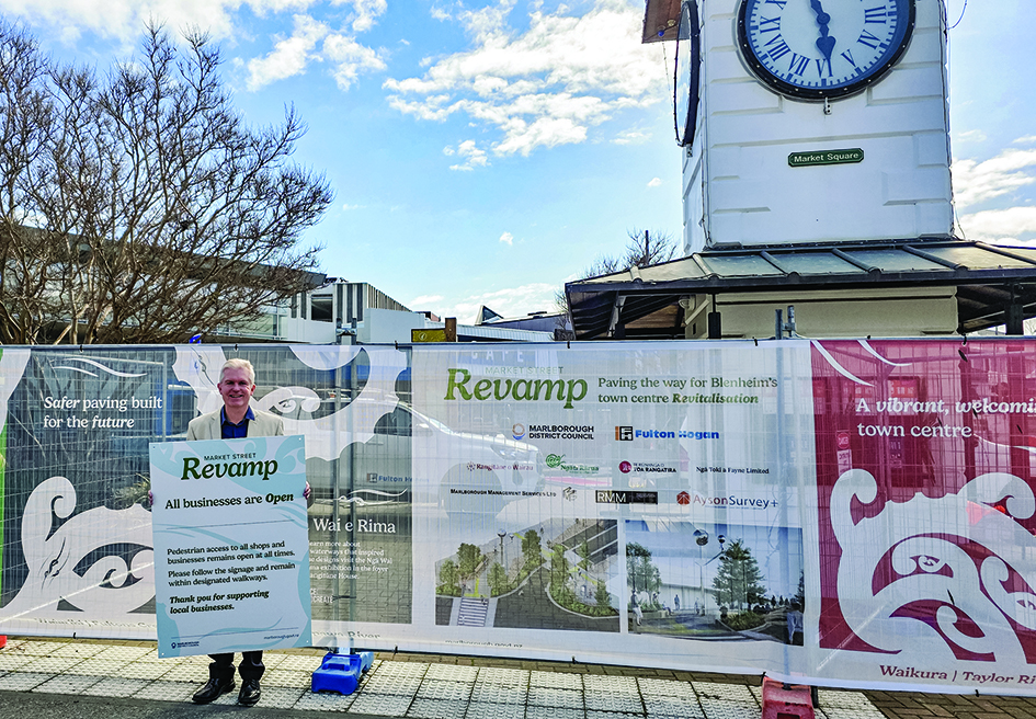
Brian Dawson promoting the 'support local' message. Photo: Supplied.
Blenheim town centre still open for business
Businesses in Blenheim’s town centre remain open and ready to welcome customers while the Market Street Revamp continues.
Business Trust Marlborough recently met with a number of town centre businesses, with the support of Council, for a CBD Marketing and Collaboration Workshop.
Business Trust Marlborough Manager Brian Dawson, also a Marlborough District Councillor, said this was an excellent opportunity to come together to brainstorm ideas for the marketing of the town centre.
“There were some excellent initiatives discussed which Business Trust Marlborough is keen to work with town centre business owners to develop.
“One of the most important messages for our community is ‘please support local’. This is always important but particularly so for our town centre during this construction phase of the Market Street Revamp,” he said.
Council is delivering both stages of the revitalisation project as a single, coordinated construction programme to maximise efficiencies, reduce duplication and shorten the overall construction timeframe.
Projects and Contracts Manager Loren Coffey said maintaining pedestrian access remained a priority throughout the works.
“Council and contractor Fulton Hogan are very mindful of the need to ensure people can continue to access town centre businesses safely while the revamp progresses,” she said.
For more information go to: https://links.marlborough.govt.nz/Market-Street-Revamp
__________________
One year of CoastSnap at Rārangi

Did you know Rārangi has its very own CoastSnap station?
Installed at the Monkey Bay steps in 2025, the CoastSnap station has spent the past year helping Council's Coastal Science team collect data along the coastline.
Coastal Scientist Jorgia McMillan said every photo taken by members of the public contributes to a growing record of how Rārangi Beach is changing over time, highlighting the important role the community plays in helping monitor the coast.
“CoastSnap is a low-cost community beach monitoring programme that turns smartphones into valuable scientific tools.
“All you need to do is place your phone in the cradle, take a photo, and scan the QR code to upload your image. You can also use the free CoastSnap app or share your photos using #CoastSnapRārangi.
“After 5 years, these images will be analysed with shoreline tracking technology to help us better understand the effects of storms, tides, wave action and seasonal change on this dynamic stretch of coastline,” Jorgia said.
__________________
EPlan goes live 1 September
Council’s new EPlan digital planning platform is available for use from 1 September.
EPlan enables Council to publish, manage, and maintain the Proposed Marlborough Environment Plan (PMEP) in an accessible online format.
During the appeal process, the PMEP was made available for viewing as a collection of PDF documents. EPlan will allow users to easily search planning provisions.
It also has an interactive mapping function that enables people to quickly view the planning provisions and rules affecting a specific property.
As part of the transition to EPlan, Council will continue to maintain the PDF versions on the website for approximately three months.
After this period, the PDF documents will be removed from the website, with EPlan becoming the primary source for accessing the PMEP.
__________________
Flood report helps mitigate future risk
A comprehensive flood frequency report has provided Council with a current and robust evidence base for understanding flood risk across the Wairau Catchment.
The Wairau Catchment Flood Frequency Assessment Report 2025, prepared by Earth Sciences New Zealand, is the first wide-ranging update of flood frequency information for the catchment since 1993 and incorporates more than three decades of additional river monitoring data.
The assessment, presented to August’s Environment and Planning Committee, provides flood frequency analysis across major sub-catchments of Marlborough’s largest river system, which is central to the region’s flood management framework.
For the first time, sub-catchments, such as the Taylor, Omaka, Tuamarina and Goulter rivers have been assessed within a consistent flood frequency framework, improving Council’s understanding of flood risk across the wider catchment.
The work has undergone a robust technical assurance process through Earth Sciences New Zealand and an internal review by Council’s Hydrological Working Group, providing confidence in its future application.
The updated information strengthens the evidence base that supports Council’s future planning, investment and risk management decisions.
The Wairau Valley Floodways Scheme was established in 1960 to provide flood protection against a one-in-100-year flood event in the Wairau and Taylor/Ōpaoa Rivers. It was reviewed in 1994 when the spatial extent of levels of service were adjusted.
The 1993 flood frequency analysis established peak flows of 5,500 cubic metres per second for the Wairau at Barnetts Bank and 170 cumecs for the Taylor River at Hutcheson Bridge.
The updated assessment now estimates one-in-100-year peak flows of 5,850 cumecs for the Wairau and 200 cumecs for the Taylor River.
While these updated flow estimates do not change Council’s existing level of service, they indicated improvements to parts of the flood protection scheme are likely to be required. A detailed assessment is now underway which will recommend immediate, interim and longer-term mitigation measures.