Sea level rise maps in Marlborough reveal areas most at risk

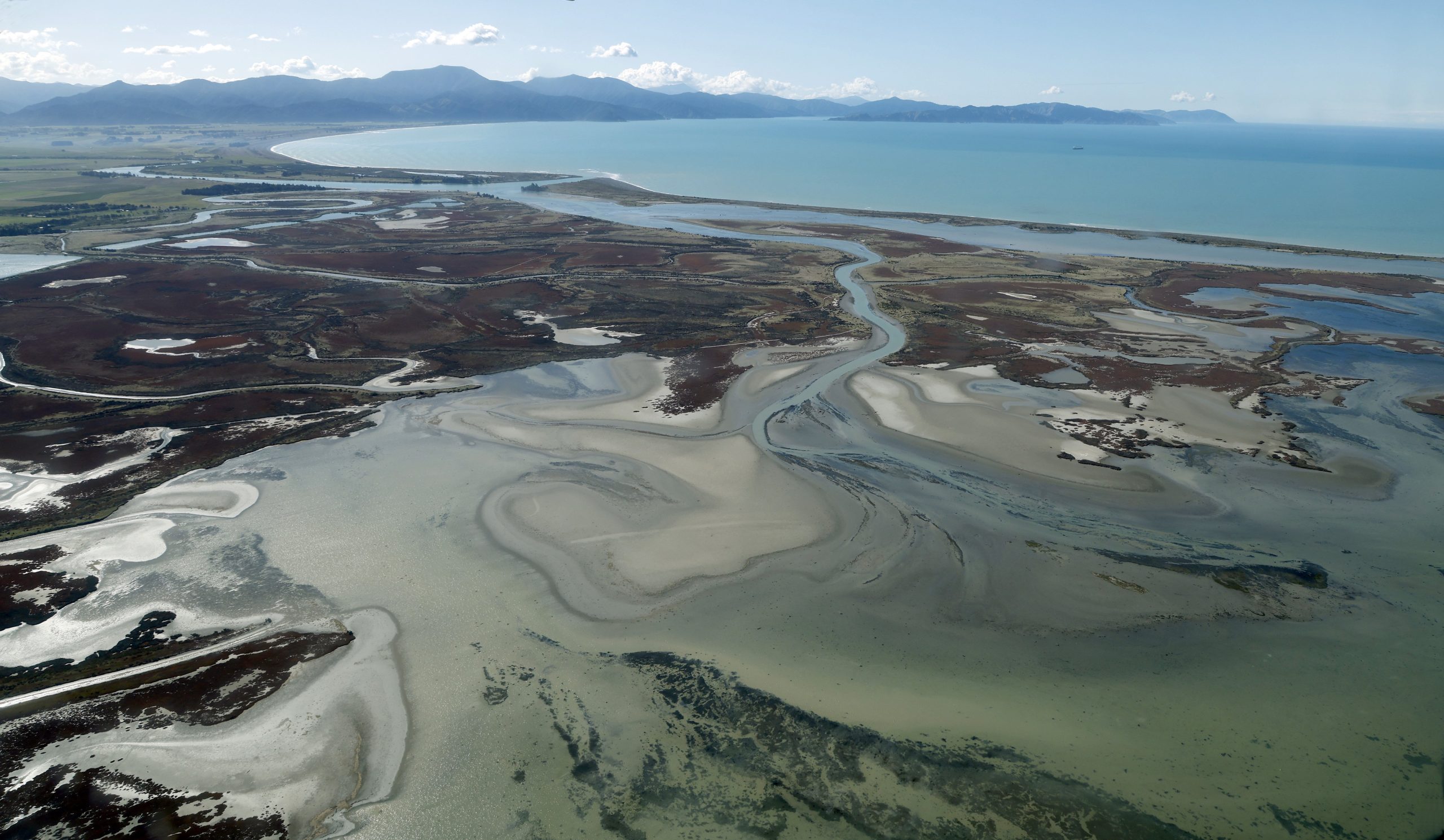
The lower Wairau River plain is at risk of becoming inundated, new research has found. Photo: Anthony Phelps/Stuff
Low-lying parts of the Wairau River plain, near a nationally significant archaeological site, are particularly sensitive to the effects of sea level rise, new research has found.
The Marlborough District Council earlier this year engaged Niwa to model sea level rise in what was said to be a “true representation” the wider community could trust.
The initial mapping was presented in a report to the council’s environment and planning committee on Thursday.
The modelling looked at both the likely permanent sea level rise, and the extreme sea level rise seen in one-in-100 year events, taking into account effects of waves, astronomical tides and storm surge, the report said.
Based on projections from the Ministry for the Environment, and depending on the amount of greenhouse gas emissions, sea level rise could be between 20cm and 33cm by 2050, 38cm and 90cm by 2090, and up to 160cm by 2130. The upper measurements were considered a “worst case scenario” for each year.

It was expected to particularly impact low-lying parts of Picton, Havelock and the lower Wairau River plain. Other areas such as the Marlborough Sounds had a steeper backshore.
The assessment used a “bathtub” model to produce maps that showed the “spatial extent” of sea level rise, the report said. Any land below the projected level was assumed to be inundated with water.
The report said land that was lower than the inundation level but not connected to the sea could see increased groundwater levels or increased susceptibility to catchment-based flooding, due to higher coastal water levels.
But, it said the bathtub model came with “caveats”, as it did not account for blockages, or the short length of storm tide peaks.
Niwa said “robust hydro-dynamic modelling” of the lower Wairau plain, including Blenheim, Rarangi and Boulder Bank, would improve confidence in the modelling.
The low-lying areas of Wairau River plain, mostly agricultural land near the Wairau Bar, were particularly sensitive to sea level rise.

“By 2050, the existing flood defences are likely to maintain normal tidal variations,” the report said.
“However, large areas of the Lower Wairau River Plain are likely to be situated below high tide level.
“Assuming no further flood protection or modification, by 2130 much of these areas have the potential to be permanently inundated.”
Council’s chief executive Mark Wheeler told the committee a lot of resilience planning was being done to cope with sea level rise, particularly by the Ministry for Environment.
Assets and services manager Richard Coningham said more detailed study would help inform where the council should raise stopbanks.
Planning and finance committee chairperson Gerald Hope said there were protective mechanisms that were “doable”.
The modelling project was a specific action in the council’s climate action plan, published in 2020.
More information could be found on the council’s website: https://www.marlborough.govt.nz/environment/climate-change.
Public Interest Journalism funded through NZ on Air.