Wild, wet and windy night across Marlborough expected, emergency crews on standby

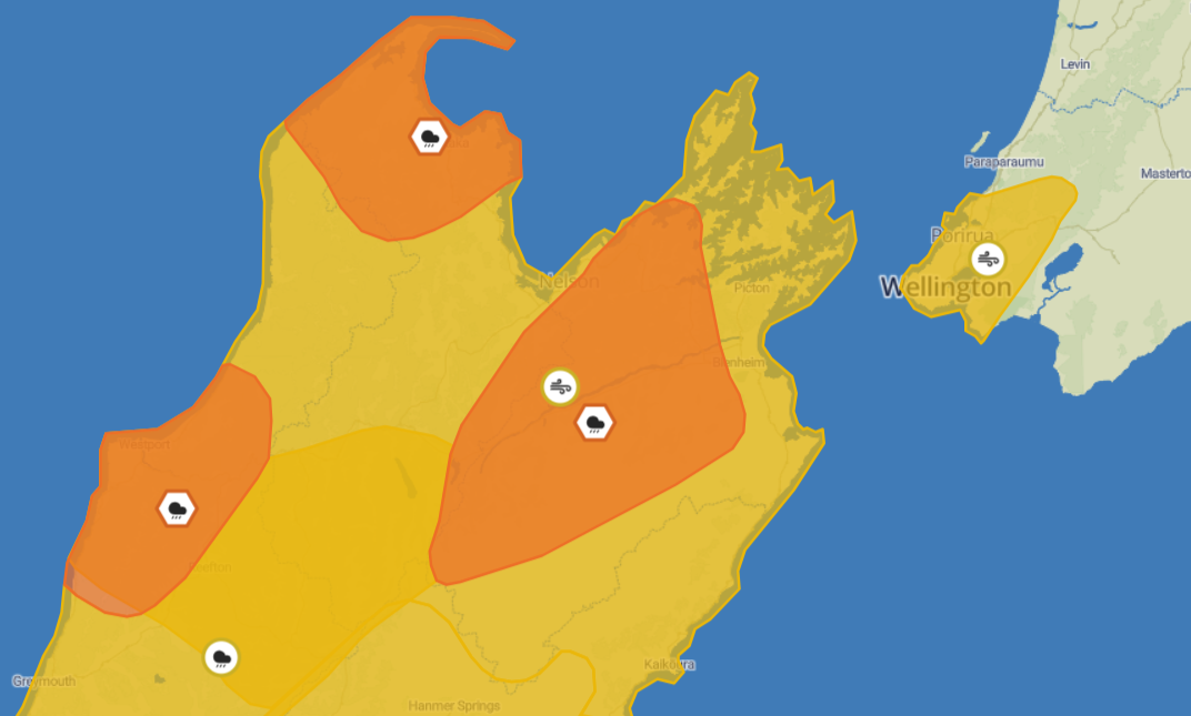
Metservice weather warnings across Marlborough as of 3.30pm Thursday.
A ‘significant’ weather event that has already stranded some on the West Coast is expected to impact the Top of the South with heavy rain, wind and rising river levels throughout Thursday evening and Friday morning.
The Bryant Range and inland Marlborough west of Blenheim and north of the Awatere River is under an orange heavy rain warning from 9am Thursday until 6am Friday, and a strong wind watch until 3am Friday.
The next Metservice warning update will be announced at 9pm this evening.
Heavy rain in the upper Wairau River catchment and Te Hoiere/Pelorus River catchment is expected to result in water levels rising significantly, with the expected peak in the Wairau being midday Friday at 3,200 to 3,300 cubic meters/second.
Council have said that their Rivers team are keeping a close eye on the situation around the region and will have updates at 5pm.
Nelson Marlborough Fire and Emergency have put out a preparation notice on their Facebook page, saying they have brought additional resources to the region to the area.
Marlborough Roads crews have also been inspecting areas vulnerable to flooding, and will be on call over night while saying depending on overnight conditions, Wairau Bar Road and Bothams Bend Road may need to close.
Call 111 for assistance if you are in trouble, and go to Marlborough District Council, NZTA Waka Kotahi Nelson, Tasman & Marlborough and Nelson Marlborough - Fire and Emergency Facebook pages for more information.